1534, presentation of a long-term work
Part 1: Hochelaga, 2015
Hochelaga, is the first opus of the photographic essay “1534” devoted to the different land points that the French explorer Jacques Cartier left his mark on. When he arrives at the Iroquois village of Hochelaga, he renamed this place Mount Royal which would later become Montreal. Almost five centuries after his first trip, the photographer returns to the footsteps of the great Saint Malo navigator in this great metropolis. In the form of a six-part photographic essay, the artist focuses her attention on observing the different roughness of the geographic and community landscape.
Part 2: Malouin, 2018
At the limit of cabotage, the photographer disembarks at Saint-Malo, formerly a bastion of privateers and the departure port for Jacques Cartier expeditions to “New France” (1534-1542). This city breathes adventure and sea spray from the sea, go to the west!
Part 3: Quebec City, 2018
The ferry takes the photographer under the imposing Chateau Frontenac, where “Le Don de Dieu”, a ship chartered for Samuel de Champlain, the city's founder in 1608, had to moor. However Quebec was discovered in 1535 by Jacques Cartier during his second voyage.
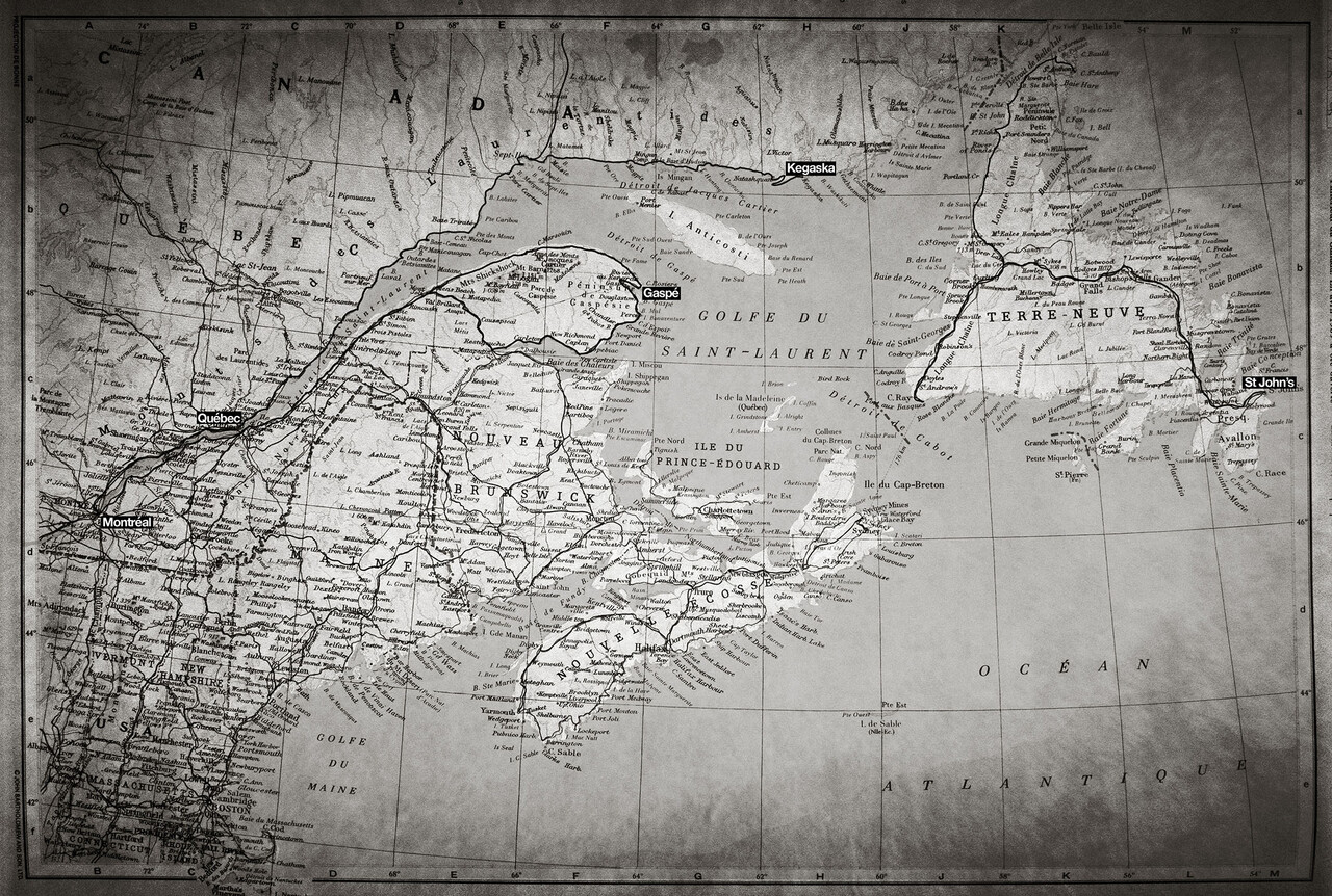
Part 4: 132, the road, 2018
Montreal - Gaspe - Matapedia - Mont-Joli - Montreal: a new two-week adventure took shape on Route 132, in Quebec. Over nearly 2,200 km, the photographer traveled this route 132 which runs along the river and the Gulf of St. Lawrence to the Baie des Chaleurs in order to soak up the various land points that the French explorer Jacques Cartier first trod in 1534.
The photographer will resume, in the best possible conditions, his adventure in order to extend his photographic essay “1534” as soon as the world health situation allows it!
Future :
Part 5: North Shore
Montreal - Kegaska - Montreal: over nearly 2,700 km of coastline, he now tackles an observation of the north shore of the St. Lawrence River. Leaving from Montreal, he devours the road to the village of Kegaska, the end point of Route 138 today, located just above the 50th parallel north, facing the Strait of Jacques Cartier and Anticosti Island. On the way back, he observes the whales in the waters rich in krill and small fish near Tadoussac.
Part 6: Quirpon-Island
Saint John's - Channel-Port-aux-Basques - Quirpon - Saint John's: the journey continues on the island of Newfoundland in order to travel on road number 1 to Channel-Port-aux-Basques then it continues due north by the 430 to reach Quirpon Island and the Strait of Belle Isle near the 52nd parallel north, a legendary passage taken by Jacques Cartier on his first trip in 1534. Now inevitable, it's back at Saint John’s International Airport, he takes Route 430 and No. 1, having traveled approximately 2,600 km since his departure with a lot of film in his bag.
In this photographic essay, Christophe Lavaud invites you to go back in time in order to generate new perspectives on our own identities in a changing world. Beyond the desire to document this period of history in the digital age is an invitation to travel through a part of this majestic Canada and to awaken, in a fresh breath of the present, visions of the past.
Hochelaga, is the first opus of the photographic essay “1534” devoted to the different land points that the French explorer Jacques Cartier left his mark on. When he arrives at the Iroquois village of Hochelaga, he renamed this place Mount Royal which would later become Montreal. Almost five centuries after his first trip, the photographer returns to the footsteps of the great Saint Malo navigator in this great metropolis. In the form of a six-part photographic essay, the artist focuses her attention on observing the different roughness of the geographic and community landscape.
Part 2: Malouin, 2018
At the limit of cabotage, the photographer disembarks at Saint-Malo, formerly a bastion of privateers and the departure port for Jacques Cartier expeditions to “New France” (1534-1542). This city breathes adventure and sea spray from the sea, go to the west!
Part 3: Quebec City, 2018
The ferry takes the photographer under the imposing Chateau Frontenac, where “Le Don de Dieu”, a ship chartered for Samuel de Champlain, the city's founder in 1608, had to moor. However Quebec was discovered in 1535 by Jacques Cartier during his second voyage.
Part 4: 132, the road, 2018
Montreal - Gaspe - Matapedia - Mont-Joli - Montreal: a new two-week adventure took shape on Route 132, in Quebec. Over nearly 2,200 km, the photographer traveled this route 132 which runs along the river and the Gulf of St. Lawrence to the Baie des Chaleurs in order to soak up the various land points that the French explorer Jacques Cartier first trod in 1534.
The photographer will resume, in the best possible conditions, his adventure in order to extend his photographic essay “1534” as soon as the world health situation allows it!
Future :
Part 5: North Shore
Montreal - Kegaska - Montreal: over nearly 2,700 km of coastline, he now tackles an observation of the north shore of the St. Lawrence River. Leaving from Montreal, he devours the road to the village of Kegaska, the end point of Route 138 today, located just above the 50th parallel north, facing the Strait of Jacques Cartier and Anticosti Island. On the way back, he observes the whales in the waters rich in krill and small fish near Tadoussac.
Part 6: Quirpon-Island
Saint John's - Channel-Port-aux-Basques - Quirpon - Saint John's: the journey continues on the island of Newfoundland in order to travel on road number 1 to Channel-Port-aux-Basques then it continues due north by the 430 to reach Quirpon Island and the Strait of Belle Isle near the 52nd parallel north, a legendary passage taken by Jacques Cartier on his first trip in 1534. Now inevitable, it's back at Saint John’s International Airport, he takes Route 430 and No. 1, having traveled approximately 2,600 km since his departure with a lot of film in his bag.
In this photographic essay, Christophe Lavaud invites you to go back in time in order to generate new perspectives on our own identities in a changing world. Beyond the desire to document this period of history in the digital age is an invitation to travel through a part of this majestic Canada and to awaken, in a fresh breath of the present, visions of the past.